

Indigenous Protected Areas
Indigenous Protected Areas (IPAs) are voluntarily dedicated by Indigenous groups on Indigenous owned or managed land or sea country.
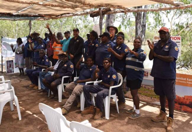
They are recognised by the Australian Government as an important part of the National Reserve System, protecting the nation’s biodiversity for the benefit of all Australians. The Caring for Country unit currently assists with the management of three IPAs: South East Arnhem Land (SEAL), Wardaman and Ganalanga-Mindibirrina.
South East Arnhem Land IPA
The South East Arnhem Land IPA Indigenous Protected Area (IPA) was declared in December 2016 and covers an area of 18,199 square kilometres. The South East Arnhem Land IPA spans most of south east Arnhem Land along the far western Gulf of Carpentaria from Blue Mud Bay to the mouth of the Roper River – where tidal flats meet vast coastal plains backed by rugged sandstone uplands. The vegetation is predominately open eucalypt woodlands with paperbark and monsoon rainforests along waterways or in moister pockets. In the north, tall eucalypt woodlands occur on the deepest soils, while a mosaic of native grasslands, vine thickets, samphire and mangroves characterise the coastal lowlands.
The South East Arnhem Land IPA consists of the traditional estates of over 20 clans who speak of themselves as Yugul. Yugul Mangi is a term for all our people, coming together and speaking as one. Their Country comprises a patchwork of homelands with twenty established outstations, each belonging to a particular family group, or clan. All homelands are associated with significant cultural sites and all are enormously important, as they reflect the pattern of our traditional land use and ownership. Homelands are places at which ceremonies occur, bush tucker is collected or hunted and where history, stories and traditional ways are passed on to our children.
The South East Arnhem Land IPA is managed by an Advisory Committee of senior elders from the Ngukurr and Numbulwar communities, who oversee the Northern Land Council managed Yugul Mangi and Numbulwar Numburindi Amalahgayag Inyung Indigenous Ranger groups.
Download: South East Arnhem Land Indigenous Protected Area Plan of Management (2016-2021).
Ganalanga-Mindibirrina IPA
The Ganalanga-Mindibirrina Indigenous Protected Area (IPA) was declared in late 2015 and encompasses the entirety of the Waanyi-Garawa Aboriginal Land Trust (ALT), a highly remote area of more than 1 million hectares of the Northern Territory’s southern Gulf. The ALT is approximately 180km South-East of Borroloola, Northern Territory and approximately 90km West of Doomadgee, Queensland (unerspend_map). The Ganalanga-Mindibirrina IPA Plan of Management 2015-2020 (PoM), a product of more than 10 years’ worth of planning by Waanyi and Garawa Traditional Owners, is currently being enacted by the Northern Land Council hosted Waanyi-Garawa Rangers and an IPA co-ordinator. The PoM explains how the Traditional Owners wish to govern and manage their lands and provides a vision for the future of their country and culture. Traditional Owners’ feedback on the execution of the plan is incorporated into management activities at biannual IPA committee meetings. The IPA has supported various activities such as fire operations, womens engagement and fire training, the bush heritage culture camp\wildlife surveys.
Download: Ganalanga-Mindibirrina Indigenous Protected Area Plan of Management 2015-2020.
Wardaman IPA
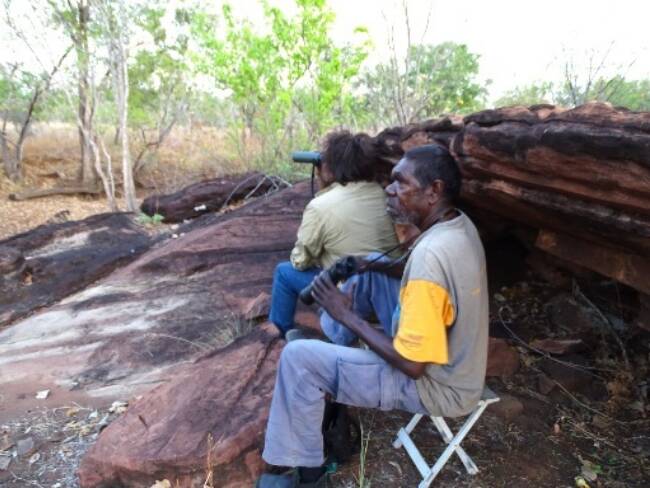
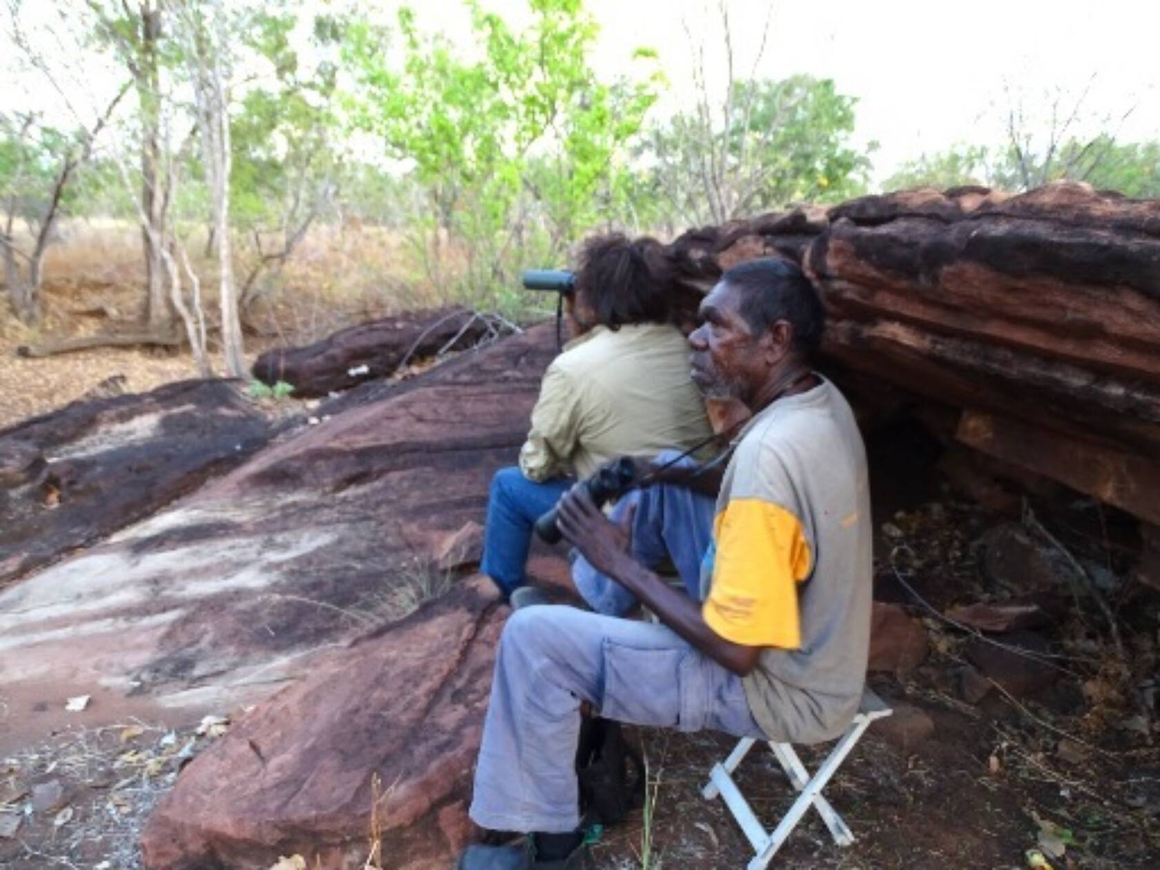
Wardaman Traditional Owner rangers monitoring for Gouldian Finch on the Wardaman IPA in October 2016.
The Wardaman IPA was declared in 2014, rangers undertake land management activities throughout the area as well as working with connecting land trusts and pastoral leases, covering over 200,000 hectares. Rangers have focused on treating extensive infestations of Gamba Grass (Andropogon gayanus), Mission Grass (Cenchrus sp.), Bellyache bush (Jatropha gossypiifolia), and Mimosa pigra. Work has been undertaken with collaboration with partners, such as the NT Weeds Branch, Territory NRM and the NLC Wagiman and Timber Creek Rangers.
The rangers have engaged with researchers to identify the near-threatened Gouldian Finch (Erythrura gouldiae) populations that may exist throughout Wardaman country and potential habitats for relocation. The surveys and scientific rigour needed to correctly undertake the survey was beneficial for the Wardaman rangers, a key experience that will enable them to continue to undertake scientific surveys in the future.
Download: Wardaman Indigenous Protected Area Management Plan